A gap analysis. What you have, what's missing, and what to check before your next program.
Aspen Geo · For Canadian explorers
Canada should set the standard for ore body knowledge.
We turn a century of paper into one record your buyer can trust.
We take every report, drill log, assay certificate and map you hold on a property and turn it into one organized record, with every number linked back to the page it came from. Queryable, visualized, and clean.
The offer
Founding offer for Canadian juniors
C$10,000For one site’s visualized and queryable knowledge base
Book a 20-minute call
Or write to [email protected]
Most delays start in the filing cabinet.
Your property's history is spread across old reports, drill logs, boxes, drives and SharePoint folders, and nobody is sure what's missing.
Now picture opening one page in your browser and seeing everything ever recorded about your property instantly, with the gaps marked and the site's value obvious.
What you get
Every document catalogued. We note who wrote it and when, and which holes and samples it covers.
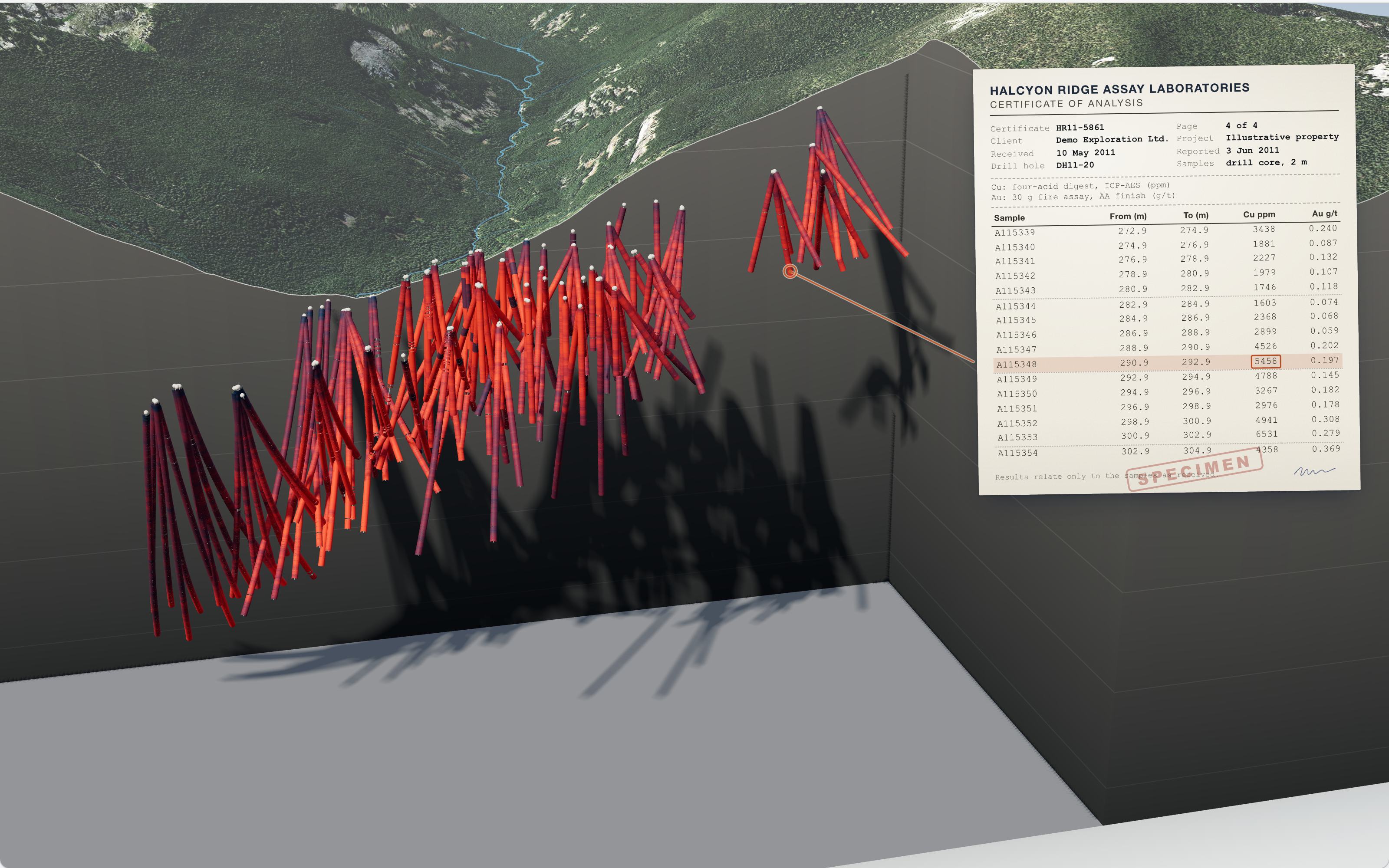
Drill holes, samples and assays in clean tables. Every value links to the page it came from.
Disagreements flagged. When two reports don't agree on a hole or a number, or a certificate has gone missing, we mark it.
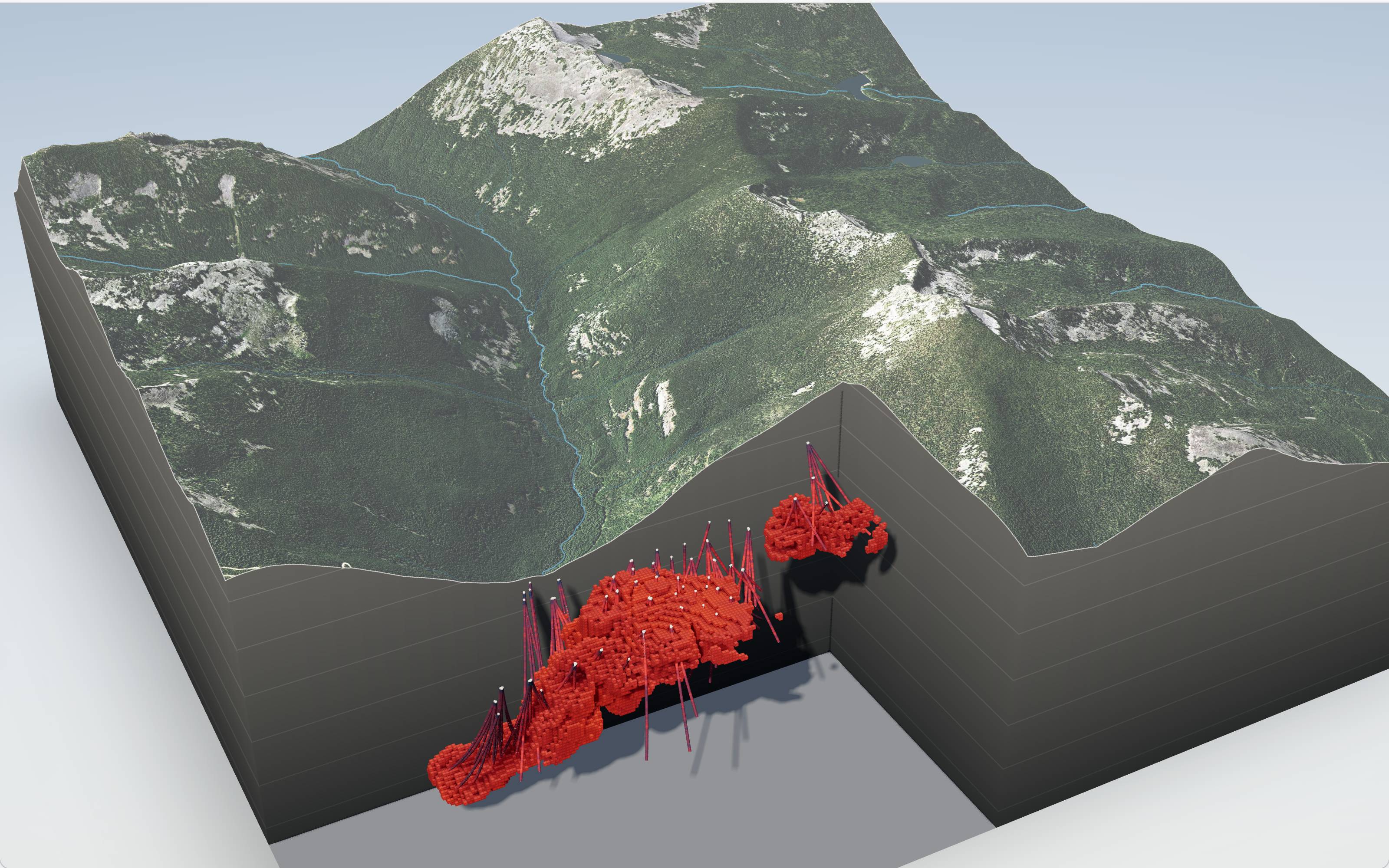
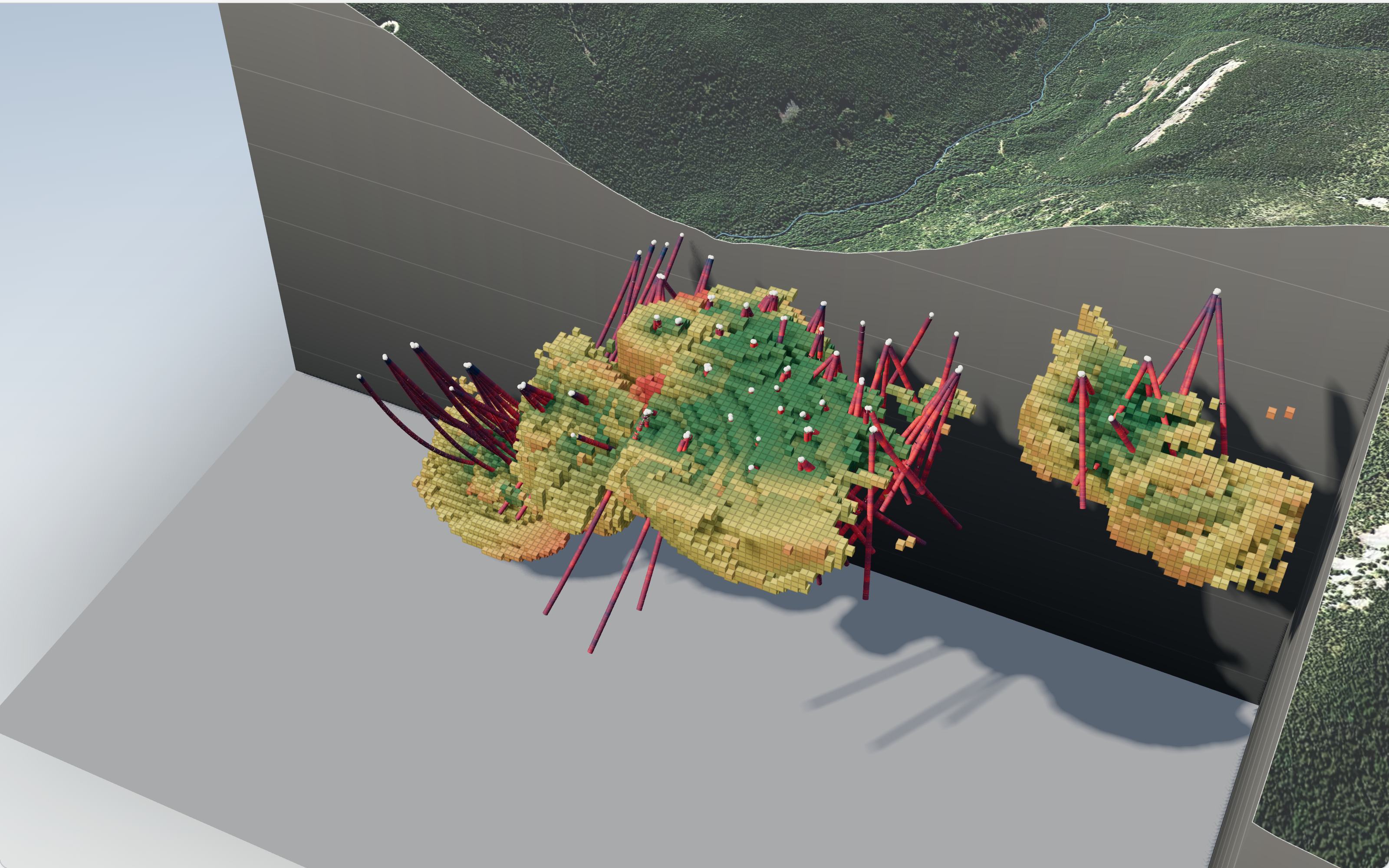
A 3D map of your property with everything on it, set on the real terrain.
A knowledge graph containing all of your data connected together, queryable and exportable to a QP or modelling software.
Have exploration money to spend before year end?
An Exploration Expense
A records compilation done to plan your next exploration program may qualify as Canadian Exploration Expense. Organize your data and make your property easier to finance, partner, and sell.
How it works
Send us what you have.
Scans, drives, old reports. Boxes too. We'll scan them.
We build the record.
It takes about four weeks.
You and your QP get it.
An online workspace, the map and the export files.
Our records are mostly handwritten. Is that a problem?
No. We read handwriting, old typewritten scans and hand-drawn maps.
Is this a 43-101?
No. It's the organized record your QP would otherwise spend weeks putting together. Your QP still writes and signs the report.
Does this count as exploration spending?
It may. A compilation done to plan your next program may qualify as Canadian Exploration Expense. Your accountant decides.
What happens after December?
The record is yours. Keep it online with us, or take the exports.
Will you keep our records private?
Yes. Your records stay private and stay yours, and we're happy to sign your NDA.
One property. One record. C$10,000.
Show potential buyers, partners, or investors the whole story instantly in a way they can trust.
Or write to [email protected]